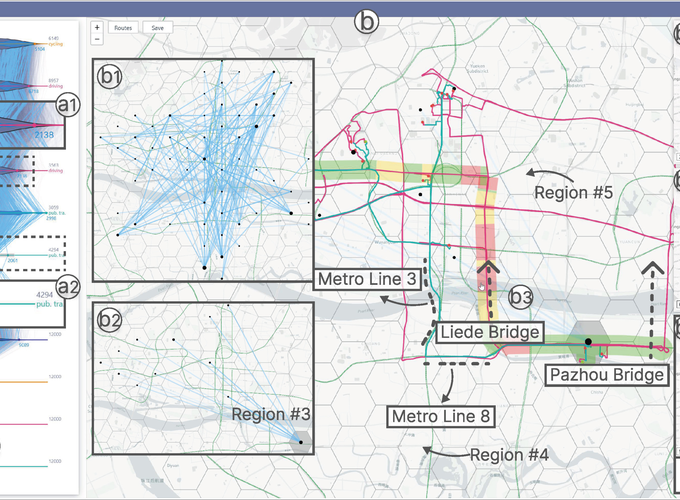
Abstract
Contemporary urban transportation systems frequently depend on a variety of modes to provide residents with travel services. Understanding a multimodal transportation system is pivotal for devising well-informed planning; however, it is also inherently challenging for traffic analysts and planners. This challenge stems from the necessity of evaluating and contrasting the quality of transportation services across multiple modes. Existing methods are constrained in offering comprehensive insights into the system, primarily due to the inadequacy of multimodal traffic data necessary for fair comparisons and their inability to equip analysts and planners with the means for exploration and reasoned analysis within the urban spatial context. To this end, we first acquire sufficient multimodal trips leveraging well-established navigation platforms that can estimate the routes with the least travel time given an origin and a destination (an OD pair). We also propose TraDyssey, a visual analytics system that enables analysts and planners to evaluate and compare multiple modes by exploring acquired massive multimodal trips. TraDyssey follows a streamlined query-and-explore workflow supported by user-friendly and effective interactive visualizations. Specifically, a revisited difference-aware parallel coordinate plot (PCP) is designed for overall mode comparisons based on multimodal trips. Trip groups can be flexibly queried on the PCP based on differential features across modes. The queried trips are then organized and presented on a geographic map by OD pairs, forming a group-OD-trip hierarchy of visual exploration. Domain experts gained valuable insights into transportation planning through real-world case studies using TraDyssey.