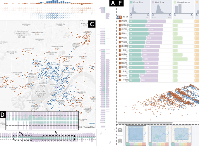
Abstract
Interactive ranking techniques have substantially promoted analysts’ ability in making judicious and informed decisions effectively based on multiple criteria. However, the existing techniques cannot satisfactorily support the analysis tasks involved in ranking large-scale spatial alternatives, such as selecting optimal locations for chain stores, where the complex spatial contexts involved are essential to the decision-making process. Limitations observed in the prior attempts of integrating rankings with spatial contexts motivate us to develop a context-integrated visual ranking technique. Based on a set of generic design requirements we summarized by collaborating with domain experts, we propose SRVis, a novel spatial ranking visualization technique that supports efficient spatial multi-criteria decision-making processes by addressing three major challenges in the aforementioned context integration, namely, a) the presentation of spatial rankings and contexts, b) the scalability of rankings’ visual representations, and c) the analysis of context-integrated spatial rankings. Specifically, we encode massive rankings and their cause with scalable matrix-based visualizations and stacked bar charts based on a novel two-phase optimization framework that minimizes the information loss, and the flexible spatial filtering and intuitive comparative analysis are adopted to enable the in-depth evaluation of the rankings and assist users in selecting the best spatial alternative. The effectiveness of the proposed technique has been evaluated and demonstrated with an empirical study of optimization methods, two case studies, and expert interviews.